
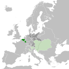
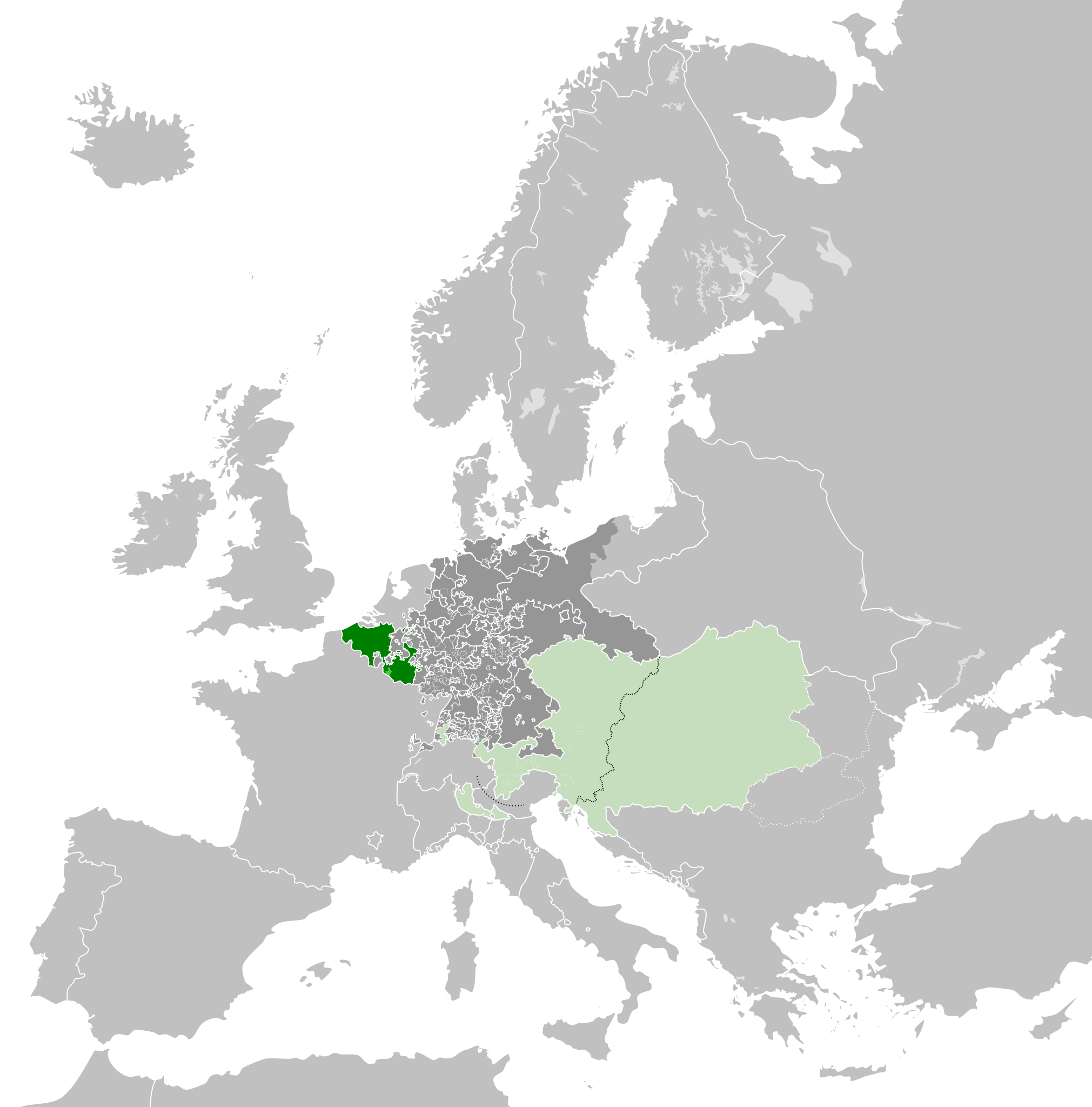
Slika:Austrian Netherlands 1789.svg

Velikost tega predogleda PNG datoteke SVG: 450 × 456 točk. Druge ločljivosti: 237 × 240 točk | 474 × 480 točk | 758 × 768 točk | 1.011 × 1.024 točk | 2.021 × 2.048 točk.
Izvorna datoteka (Datoteka SVG, nominalno 450 × 456 pikslov, velikost datoteke: 858 KB)
Spodaj prikazane informacije so s tamkajšnje opisne strani.
Povzetek


.svg)
.svg)
.svg)
.svg)
.svg)


.svg)
.svg)
.svg)


.png)
.png)


.svg)


.svg)

.svg)


.svg)
.svg)
.svg)
.svg)


.svg)
.png)


.svg)


.svg)
.svg)


.svg)


.svg)


.svg)
.svg)
.svg)
.svg)
.svg)
.svg)
.svg)
_cropped.svg)
.svg)
.svg)
.svg)
.svg)
.svg)
.svg)
.svg)
.svg)
.svg)
.svg)
.svg)
.svg)
.svg)
.svg)
.svg)
.svg)
.svg)
.svg)
.svg)
.svg)
.svg)
.svg)
.svg)
.svg)
.svg)
.svg)
.svg)
.svg)
.svg)
.svg)
.svg)
.svg)
.svg)
.svg)
.svg)
.svg)
.svg)
.svg)
.svg)
.svg)
.svg)
.svg)
.svg)
.svg)
.svg)
Licenca
Jaz, imetnik avtorskih pravic na tem delu, ga objavljam pod naslednjo licenco:
Datoteka je objavljena pod licenco Creative Commons Priznanje avtorstva-Deljenje pod enakimi pogoji 3.0 Brez predelav.
- Dovoljeno vam je:
- deljenje – reproducirati, distribuirati in javno priobčevati delo
- predelava – predelati delo
- Pod naslednjimi pogoji:
- priznanje avtorstva – Navesti morate ustrezno avtorstvo, povezavo do licence in morebitne spremembe. To lahko storite na kakršen koli primeren način, vendar ne na način, ki bi nakazoval, da dajalec licence podpira vas ali vašo uporabo dela.
- deljenje pod enakimi pogoji – Če boste to vsebino predelali, preoblikovali ali uporabili kot izhodišče za drugo delo, morate svoj prispevek distribuirati pod enako ali združljivo licenco, kot jo ima izvirnik.
Izvorni dnevniški zapis naložitve
This image is a derivative work of the following images:
- File:Europe_1789.svg licensed with Cc-by-sa-3.0
- 2013-04-14T03:44:26Z Alphathon 450x456 (858577 Bytes) Corrected some errors in northern Italy
- 2013-04-14T01:38:01Z Alphathon 450x456 (853881 Bytes) tweaked again
- 2013-04-14T01:36:10Z Alphathon 450x456 (853881 Bytes) Tweaked Holy Roman Empire border style
- 2013-04-14T01:33:26Z Alphathon 450x456 (853857 Bytes) == {{int:filedesc}} == {{Information |Description={{en|A blank Map of Europe circa 1789. This map also includes a border for the [[:en:Holy Roman Empire|Holy Roman Empire]]. Since there are so many small German states, they h
Uploaded with derivativeFX
Zgodovina datoteke
Kliknite datum in čas za ogled datoteke, ki je bila takrat naložena.
| Datum in čas | Sličica | Velikost | Uporabnik | Komentar | |
|---|---|---|---|---|---|
| trenutno | 09:38, 17. oktober 2021 | | 450 × 456 (858 KB) | Fenn-O-maniC | Wrong file |
| 09:38, 17. oktober 2021 |  | 450 × 456 (800 KB) | Fenn-O-maniC | Fixed the Russo-Swedish border to match the Treaty of Åbo of 1743 | |
| 09:36, 17. oktober 2021 |  | 450 × 456 (858 KB) | Fenn-O-maniC | Fixed the Russo-Swedish border to match the Treaty of Åbo of 1743 | |
| 22:34, 18. april 2013 |  | 450 × 456 (878 KB) | Alphathon | Style change | |
| 20:34, 18. april 2013 |  | 450 × 456 (857 KB) | Alphathon | Various fixes | |
| 22:31, 15. april 2013 |  | 450 × 456 (854 KB) | Alphathon | Corrected Scandinavian borders | |
| 01:18, 15. april 2013 |  | 450 × 456 (839 KB) | Alphathon | Changed colour of the remainder of the Habsburg Monarchy | |
| 15:29, 14. april 2013 |  | 450 × 456 (839 KB) | Alphathon | == {{int:filedesc}} == {{Information |Description={{en|A map of the Austrian Netherlands within the Habsburg Monarchy, the Holy Roman Empire and Europe circa 1789.}}{{de|Eine Landkarte die [[:de:Öste... |
Uporaba datoteke
Datoteka je del naslednje 1 strani slovenske Wikipedije (strani drugih projektov niso navedene):
Globalna uporaba datoteke
To datoteko uporabljajo tudi naslednji vikiji:
- Uporaba na ar.wikipedia.org
- Uporaba na ast.wikipedia.org
- Uporaba na bg.wikipedia.org
- Uporaba na cs.wikipedia.org
- Uporaba na en.wikipedia.org
- Uporaba na eo.wikipedia.org
- Uporaba na et.wikipedia.org
- Uporaba na eu.wikipedia.org
- Uporaba na fa.wikipedia.org
- Uporaba na fi.wikipedia.org
- Uporaba na fr.wikipedia.org
- Uporaba na gl.wikipedia.org
- Uporaba na he.wikipedia.org
- Uporaba na id.wikipedia.org
- Uporaba na is.wikipedia.org
- Uporaba na it.wikipedia.org
- Uporaba na ja.wikipedia.org
- Uporaba na ko.wikipedia.org
- Uporaba na lv.wikipedia.org
- Uporaba na mk.wikipedia.org
- Uporaba na pt.wikipedia.org
- Uporaba na th.wikipedia.org
- Uporaba na tr.wikipedia.org
- Uporaba na uk.wikipedia.org
- Uporaba na vi.wikipedia.org
- Uporaba na www.wikidata.org
- Uporaba na zh.wikipedia.org